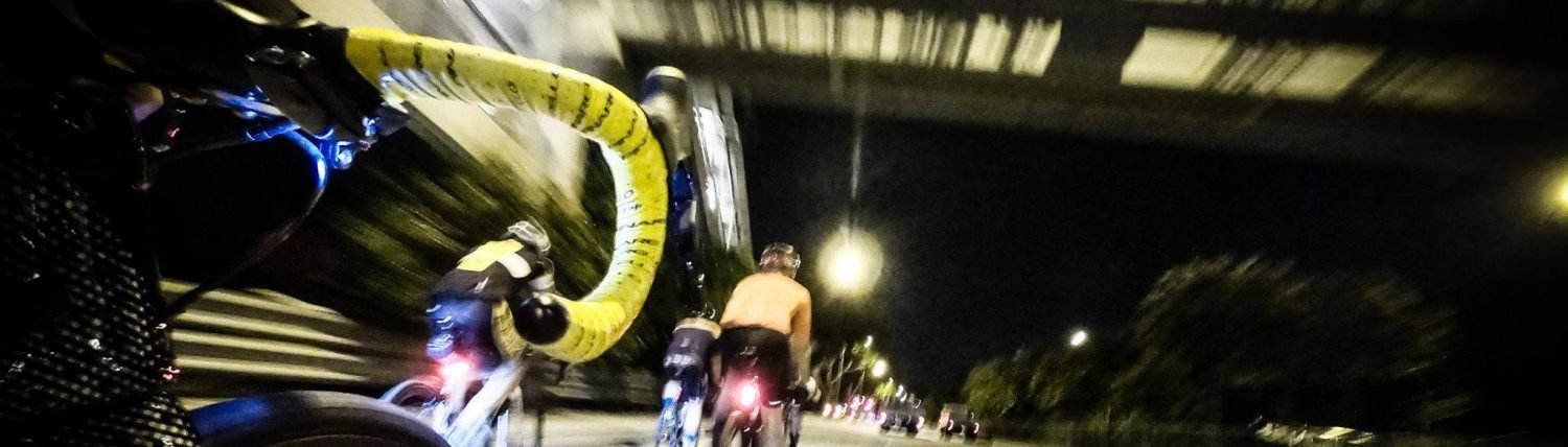
There are many cycling videos online. Most of them are purely raw footages taken from various angles. Raw footages are boring. I started a cycling vlog of sorts in early 2015 which began that way before quickly realising I could add data overlays for free. It makes your videos slightly more interesting with minimal effort. You need camera footage shot by any camera, a FIT or GPX file from your sports tracker (any brand as long it outputs to these file formats, which most do) and Garmin’s VIRB Edit software. Even though the software is made by Garmin, it accepts videos and FIT/GPX files from non*Garmin cameras and sports trackers, which is rather nice of Garmin.
Garmin’s VIRB Edit software is easy to use. Load your camera footage, select the FIT/GPX file and then synchronise your video to the FIT/GPX file. Synchronising is the most important step. Make sure your FIT/GPX files indicate where you are on the map at that point in time in the video. You can make the adjustments accordingly either by scrolling through the video or by changing the spot on the map where your video indicates you are. This is done in the screen below which places the video and map side by side for easy adjustments.
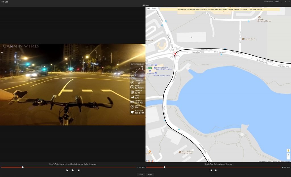
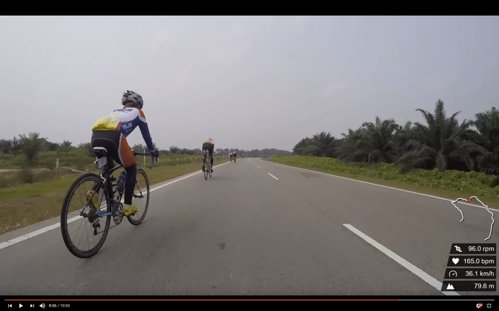
Your other data – power, speed, cadence, heart rate, etc are tagged to location. Hence, getting the location right is key. After that, play around with the available data overlays or create your own before exporting the video. It is that simple. Here are some tips:
- Syncing FIT/GPX to camera footage. It is difficult to get the exact point correct unless you make use of areas where you make turns. You can either use the exact point of the turn or the point where you veer off from a straight line to get the adjustment right. In areas where you go on a straight path for an incredibly long period of time, use junctions or adjacent roads as markers. Sync your footage and your FIT/GPX file at the moment where you cross the junction/adjacent road.
- Working with GoPro footage. My video recording device is a GoPro 4 Silver. GoPro chops ups its captured footage into file sizes of 4GB. This is called chaptering and I suspect many other cameras do the same. What I prefer to do is to combine all these “chapters” into one long video before loading the combined video in VIRB Edit. Doing so means that I only need to sync the FIT/GPX file once and the entire video lines up perfectly with the map.
- FIT/GPX limitations. There will be areas where the data from your FIT/GPX file will make zero sense. This is down to your sports tracker. Especially in areas where there are very high rise buildings packed together, your sports tracker will find it hard to get an accurate GPS reading due to interference. This will cause your position on the map to be inaccurate. (A tell tale sign is when you see a squiggly line on a route that should be straight.) Hence, sync your video at areas that are unhindered which allows more precise GPS logging.
- Further processing. I use Garmin VIRB Edit purely for data overlays. Once Garmin VIRB Edit spits out the combined footage, I put the video through Adobe Premiere for post production mostly because Adobe Premiere provides more flexibility and I am comfortable with the software (though it definitely is not free). I do not have much time for post production so it is limited to simply trimming the video, colour correction, adding music and including title slides and transitions.
The overall production time for syncing FIT/GPX to video and simple post production should not exceed an hour or so depending on video length. Of course, this does not include the time your computer takes to render the actual video. (You can leave your computer alone during rendering anyways.) Have fun and send me links to your videos!
Thanks for the article. This works for me too! Now I just have to find the best way to get GPX files out of my Timex Ironman GPS watch. I don’t really want to pay $5 / month to strava.com just for that function!
Glad it worked for you. You might want to try the Timex Connect application to see if you can retrieve GPX files from your watch.
You can get GPX files from an Android phone, with the app GPX recorder or GPS Speedometer.
can i still do this without a garmin comp?
Yes you can use any device. Just extract the GPX or FIT file and you are good to go.
Dave, have you tried this lately? I’ve been using this method for awhile but today the g-metrix sync won’t work because it’s apparently still trying to use Internet Explorer to access Google Maps.
Hi Tom, I have not done this for quite a while. I will look into it in a month. In the meantime, you might want to look at a similar situation faced by Picasa 3 users. (Picasa 3 is an unrelated outdated software facing the same issue of having Internet Explorer access Google Maps.) A Windows Registry fix works for Picasa but not sure if it applies to the VIRB Edit software. https://www.picxl.de/picasa3-maps-fehlerbehebung/
To add, what I will try would be to add a DWORD (32-bit) value in: Computer\HKEY_CURRENT_USER\Software\Microsoft\Internet Explorer\Main\FeatureControl\FEATURE_BROWSER_EMULATION.
The DWORD (32-bit) value name should be the VIRB Edit’s exe file name, value data should be 0, and base should be hexadecimal.
This seems to have worked for me. Windows 10 64bit 31 July 2023
Glad to hear!
VIRB is not supported anymore, unfortunately. But if you use davinci/adobe premiere pro to edit your videos, https://gpxoverlay.com/?utm_source=tempo may help you. Simple, free and works as a charm
Thanks for the tip!